

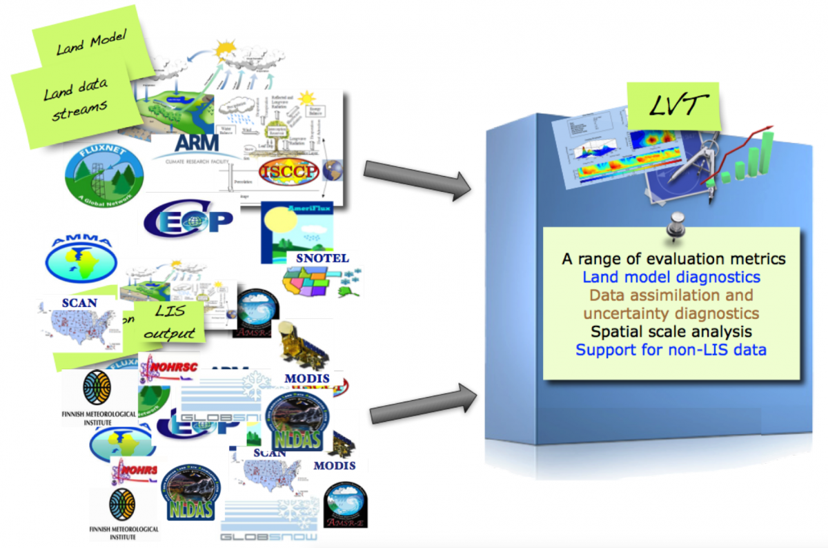
The Land surface Verification Toolkit (LVT) is designed to enable the evaluation, analysis, comparison, and benchmarking of outputs generated by the Land Information System. LVT can also analyze the outputs from the LIS data assimilation, optimization, and uncertainty sub-systems. The tool provides schemes for the incorporation of multiple observational (in-situ, remote sensing and model/reanalysis) data sources and handles the required temporal and geo-spatial transformations as well as a wide suite of deterministic, categorical, and probabilistic verification metrics. LVT can also be used for the analysis of land-relevant, non-LIS datasets.
Designed as an object-oriented software package written in Fortran and C programming languages, LVT works seamlessly with LIS to provide an integrated, uniform approach for land surface verification. Modeled estimates of land surface conditions generated by LIS are typically evaluated by comparing them with data from observational networks, remote-sensing platforms and similar estimates from other modeling frameworks.
Features
- LVT allows evaluation, analysis, and comparison of terrestrial hydrology datasets including outputs generated by the Land Information System
- LVT provides an integrated, uniform approach for land surface verification, evaluation, and benchmarking
- LVT incorporates multiple observational data sources (in-situ, remote sensing, and model/reanalysis)
- LVT handles the required geo-spatial and temporal transformations
- LVT can use a wide suite of verification metrics
Functional Goals
- Inter-comparison of hydrological datasets against each other (e.g. LIS soil moisture output vs. in-situ measurements, SMOS soil moisture vs. NLDAS outputs).
- Provides tools to develop benchmarks or a priori expectations of performance. For example, the tools in LVT can be used to develop linear regression models of land outputs (e.g., latent heat flux) to pre-defined inputs (e.g., shortwave radiation). The land model outputs could be then compared against these benchmarks.
- Provides tools to develop end-user oriented products and indicators. For example, LVT can be used to generate normalized indicators of drought/flood severity.
- Provides the capabilities for the analysis of outputs from different computational subsystems of LIS. For example, the data assimilation subsystem outputs from LIS can be processed through LVT to develop DA related diagnostics.
LVT is implemented using object-oriented framework design principles as a modular, extensible, and reusable system. The extensible interfaces in LVT provide pathways for implementing new observational data sources and analysis metrics.
How to cite when using or referring to the LVT software:
Kumar, S.V., C.D. Peters-Lidard, J. Santanello, K. Harrison, Y. Liu, and M. Shaw, 2012: Land surface Verification Toolkit (LVT) - a generalized framework for land surface model evaluation. Geosci. Model Dev., 5, 869-886, doi:10.5194/gmd-5-869-a